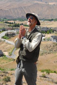
Dawes, Ralph


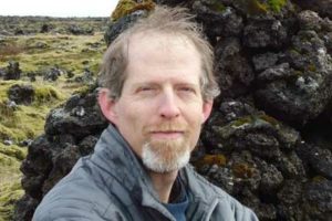
Ralph Dawes is originally from Edmonds, WA. He has a degree in literature from Antioch College in Yellow Springs, OH, and degrees in geology from WWU (BS) and the UW (MS, Ph.D.). He has taught at Wenatchee Valley College WVC) for 22 years. He is passionate about sharing how the geologic history of the Pacific Northwest gives insight into the landslides, floods, volcanic eruptions, and earthquakes.

From his bio at WVC:

Ralph Dawes started teaching at Wenatchee Valley College in the winter of 1999. His interests include geology, chemistry and physics, and in how the physical sciences can be learned by novices through group activities and interactive techniques. Field trips in earth science classes, in which the student learns to interpret the materials and structures of the earth for him or herself, is one of his favorite activities. He also has an interest in making use of technology to create new, high-quality educational opportunities for students, and does some of his teaching online.

Earth, from the core to the atmosphere, is a primary field of interest for Ralph, including relations among earth systems, of which humans are part and take part. Astronomy, from what you can see in the night sky to what you cannot see (black holes, dark matter) are another interest of his. How the earth sciences can be experienced through group activities and interactive techniques, are a constant pursuit. He also has an interest in making use of technology to create new, high-quality educational opportunities for students and does some of his teaching online. Ralph has been president of the Northwest section of the National Association of Geoscience Teachers and on a review panel of the National Science Foundation for Earth Science Education, among other professional activities.

Dawes presented “Earthquakes: Is the coast really toast?” during the first annual WVC Speaks Lecture Series.

Ralph is originally from Edmonds, Washington. He has a degree in literature from Antioch College in Yellow Springs, Ohio, and degrees in geology/geochemistry from Western Washington University (BS) and the University of Washington (MS, PhD). His dissertation topic was “Geochemistry and Petrogenesis of Deep-Seated, Late Cretaceous Plutons of the North Cascades.”

He enjoys hiking, camping, reading and free-time geologizing.  (Updated Oct. 2021)

Williams, David B.

David B. Williams is a freelance writer in Seattle. Originally raised in Seattle, he went to college in Colorado where he initially studied physics but switched to geology (a smart move). He received a Bachelor of Arts in geology from Colorado College in 1987 was then hired by the Canyonlands Field Institute in Moab, Utah. This led to a job as an Interpretive Park Ranger at Arches National Park and then in Boston while his wife attended graduate school in 1997. He must have heard Horace Greely’s admonition of Go West Young Couple, and they returned to Seattle where he became a well-established writer of natural history books and occasional urban geology tour guide. Since 1999, he had been associated with Seattle’s Burke Museum in their education department.

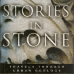
David B. Williams writes on the intersection of people and the natural world. His books include:  Stories in Stone: Travels Through Urban Geology; The Seattle Street-Smart Naturalist: Field Notes from the City; Cairns: Messengers in Stone; and Too High & Too Steep. He maintains the blog GeologyWriter.com from his home base in Seattle.  David says his interest in urban geology was sparked by the use of stone in the Downtown Seattle Transit Tunnel.

David Williams has been a frequent and interesting speaker for our lecture series (see events on 3/2/13, 11/7/15 and 5/11/19). In 2019 he announced that Stories in Stone has been republished by UW Press (https://uwapress.uw.edu/book/9780295746456/stories-in-stone/.  In addition, he continues to run has Geology walks through Seattle on a regular basis.  If interested, contact him for dates and cost. (Updated Oct. 2021)

Stories in Stone David Williams 2019 reprinted

Sea to Sky Tour – British Columbia

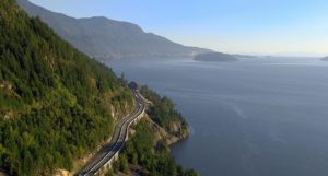
The Geology of Southwest British Columbia’s Sea to Sky Highway

British Columbia’s Sea to Sky Highway (Highway 99, connecting Vancouver to Squamish, Whistler, and Pemberton) provides a journey through the geology of British Columbia’s Coast Mountains, where relief from valley floors to summits is commonly 1500-2000 m. The highway follows the steep fjord wall of Howe Sound past waterfalls, debris flow-prone gullies, rockfall hazards, glacial erosion features, and the Britannia Beach copper mine (operational until 1974), before arriving in Squamish. The town of Squamish sits at the head of Howe Sound and is located near the 700 m cliffs of the granitic monolith, the Stawamus Chief, as well as the dormant volcano, Mount Garibaldi, and a debris fan comprising mainly volcanic material from Mount Garibaldi, including material that was originally deposited supraglacially before being remobilized when the Cordilleran ice sheet disappeared. North of Squamish, the Sea to Sky Highway climbs from a floodplain and winds its way through the Cheakamus River canyon, with views of the mountains and glaciers of the Tantalus Range to the west. The vertical cliffs of the Barrier mark the site of a mid-nineteenth century landslide from an andesite lava flow that ponded against remnants of the Cordilleran ice sheet during the waning stages of the Fraser Glaciation. At Brandywine Falls, the Brandywine River cascades over a stack of basaltic lava flows and drops 70 m into a canyon. A series of lava flows of Cheakamus basalt next to the highway show evidence for eruption beneath or beside ice. In Whistler, the gondolas to the top of the ski slopes allow for broad views of the geology of the Coast Range, including the volcano, Mount Cayley, located 15 km west of Whistler (but not visible from lower elevations). North of Whistler, Nairn Falls, located 1.5 km from the highway, has numerous large potholes and other features eroded by water. The town of Pemberton lies about 60 km southeast of the volcano, Mount Meager, which in 2010 was the source of the largest historic landslide in Canada (about 49 million m3). Although Mount Meager occupies only 2.5% of the area of the Lillooet River watershed, it is the source of 25-75% of all the sediment deposited in the Lillooet River valley during the Holocene. Three prehistoric debris flows from Mount Meager, including one contemporaneous with its 2350 BP eruption, reached as far as currently inhabited areas of Pemberton. This eruption, the only known explosive Holocene eruption in Canada, left an ash layer that today can be traced as far as central Alberta, more than 500 km downwind.

Melanie Kelman

If you are considering a road trip in nearby Canada, this might be the one for you.  You’ll see how glaciation, erosion, the sea, volcanoes, and man have shaped this landscape.  In addition, the Looney is cheap (80 U.S. cents), the people are friendly, and the landscapes are fantastic.

Click here to download the full tour brochure…


About the Speaker

Melanie Kelman completed her Ph.D. at the University of British Columbia in 2005, where she studied the Mount Cayley volcanic field. She first became in geology as a child, when her father, a rock collector, took the family to quarries, gravelly lakeshores, and mine dumps around western Canada and the U.S.  Melanie started work in October 2007 with Natural Resources Canada in Vancouver.  She currently devotes her time to volcanic-hazard research, volcano emergency planning, and the preparation of educational materials. If volcanic unrest were to occur again in Canada, she would play a major role in monitoring, hazard assessment, and eruption forecasting.