The Lecture – Unraveling the Seattle fault zone: Main and secondary fault dynamics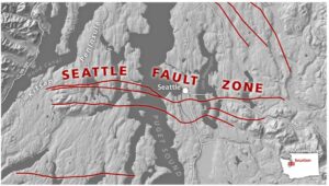
The Quimper Geological Society (QGS) is excited to have Steve Angster from the Seattle office of the U.S. Geological Survey to present details about the mapped faults within the Seattle Fault Zone (SFZ).
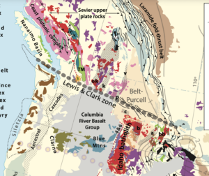
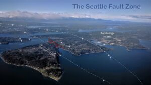
The SFZ is a complex system of south-dipping thrust faults and associated secondary structures that collectively accommodate north–south shortening beneath the central Puget Lowland. While the main Seattle Fault has long been recognized as a significant seismic hazard, growing evidence suggests that deformation is distributed across a broader zone of subsidiary faults that may rupture independently or in concert with the main structure.
This talk will synthesize recent constraints on the late Holocene (~last 4,000 years) rupture history of the SFZ, integrating paleoseismic, geomorphic, geophysical, and stratigraphic observations with new results from the Lytle Beach and Vasa Park faults. These secondary faults record late Pleistocene and possibly historic earthquakes that provide important insight into rupture segmentation, timing, and fault interactions within the SFZ. Together, these data refine our understanding of how strain is partitioned across the fault zone and have implications for earthquake magnitude estimates and hazard assessments in the Seattle metropolitan region.
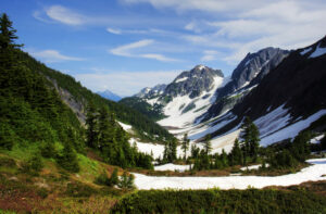
This IN-PERSON lecture will begin at 4 PM on Saturday, April 18, 2026, at the First Baptist Church, 1202 Lawrence Street. Entrance is in the back. Doors open at 3:30 PM. This lecture will be recorded and posted shortly after the presentation, as are all our lectures since 2020.
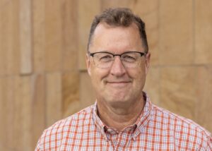
About the Speaker – Stephen Angster
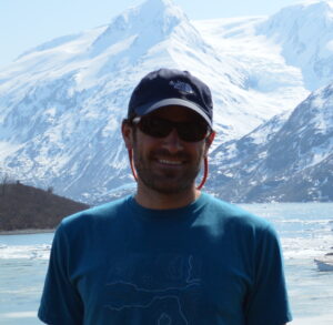
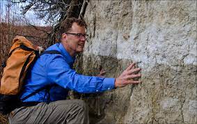
Steve is a research geologist at the Seattle Field Office of the U.S. Geological Survey’s Earthquake Science Center. His work focuses on characterizing and integrating upper-plate fault source parameters for probabilistic seismic hazard analysis in the Pacific Northwest, both east and west of the Cascades. He employs a multidisciplinary approach—emphasizing paleoseismic trenching as a tool alongside geophysical and geological investigations—to better understand the spatial and temporal patterns of prehistoric large earthquakes. He holds a B.S. from Western Illinois University, an M.S. from the Colorado School of Mines, and a Ph.D. from the University of Nevada, Reno.