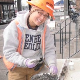
01-20-2018 Brandy Rinck: Geoarcheology
About the Talk Geoarchaeology in Washington: Hidden Landforms and Buried History Brandy Rinck presents the multi-disciplinary approach that uses methods and techniques from geology, geography, and other Earth science fields to study archaeology. This presentation considers how geoarchaeology applies to the field of cultural resources management in Washington State through example project descriptions and archaeological site accounts from the north coast of the Olympic Peninsula, the Puyallup River delta front, and the Chehalis River basin. Archaeological sites on the Olympic Peninsula are often unique in type and some contain evidence of the first people to arrive in the region after the… Read more01-20-2018 Brandy Rinck: Geoarcheology
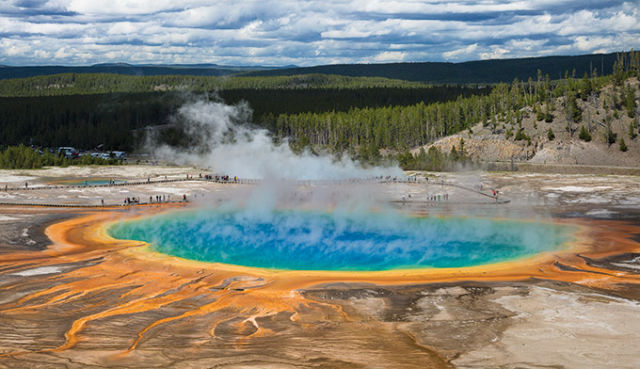
02-24-2018 Jim Aldrich: Geologic Hot Spots
About the Talk Geologic Hot Spots Under Our National Parks Jim Aldrich presents an intriguing picture of geologic hot spots through the lens of some U.S. National Parks. Geologic hotspots are the manifestation of thermally expanded, buoyant mantle “plumes” that rise through the lithosphere. On reaching the Earth’s crust they can erupt as relatively quite basalt flows and/or by violent explosive eruptions of rhyolite. This hour-long presentation will address the basics of the mantle-plume processes. Emphasis will be on the Yellowstone hotspot, which has a long and varied eruption history that began on the seafloor before being overridden by the… Read more02-24-2018 Jim Aldrich: Geologic Hot Spots
03-31-2018 Tom Badger: Landslide Hazards
About the talk Geology, gravity, and growth: the risky business of landslide hazards in Washington Landslide hazards abound in Washington State. They impact our shorelines and rivers, forests, infrastructure, homes, and livelihood; and on rare occasions, they result in loss of life. Tens to hundreds of millions of public dollars are spent annually in Washington State to mitigate for these impacts. Some of the better known hazard areas for frequent and/or large-volume landslides are associated with the glacial deposits of the Puget Lowland, the marine sedimentary rocks of the Olympic Peninsula and Willapa Hills, and the basalt-sedimentary interbed sequences of the… Read more03-31-2018 Tom Badger: Landslide Hazards
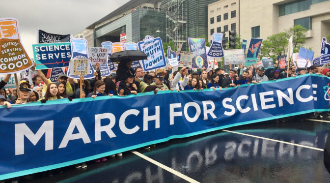
04-14-2018 Let’s March for Science
Sat. April 14, Seattle Jefferson Land Trust Geology Group will march. The Seattle route map, access, and FAQ’s are now posted on the March for Science website. We’ll post details about our involvement about a week before the event. Carpooling, how to get from the ferry to Cal Anderson Park (start point), duration, etc. If you have specific questions, contact me at Paleoseis@gmail.com Click to see and join Facebook group for latest news … In the news… Time Magazine 2018 – Why more scientists are running for office…
05-19-18 Melanie Kelman: Vancouver to Whistler, B.C. Geology
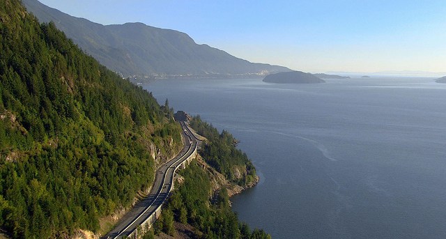
About the Talk The Geology of Southwest British Columbia’s Sea to Sky Region British Columbia’s Sea to Sky Highway (Highway 99, connecting Vancouver to Squamish, Whistler, and Pemberton) provides a journey through the geology of British Columbia’s Coast Mountains, where relief from valley floors to summits is commonly 1500-2000 m. The highway follows the steep fjord wall of Howe Sound past waterfalls, debris flow-prone gullies, rockfall hazards, glacial erosion features, and the Britannia Beach copper mine (operational until 1974), before arriving in Squamish. The town of Squamish sits at the head of Howe Sound and is located near the 700… Read more05-19-18 Melanie Kelman: Vancouver to Whistler, B.C. Geology
09-29-2018 John Pallister: Volcanic Disasters and Hazards to Aircraft
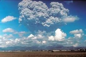
Sat. Sept, 29, 3-5 pm; John Pallister—VDAP & Volcanic Hazards to Aircraft Meeting Location Port Townsend Aero Museum 105 Airport Road Port Townsend This special venue is a private museum dedicated to preserving aircraft history of the Pacific Northwest through restoration, maintenance, and repair of aircraft. About the Lecture In this talk, John Pallister (U.S. Geological Survey) will describe the Volcanic Disaster Assistance Program and how volcanic eruptions can have disastrous consequences for aircraft. Until recently, most radar systems did not image the ash plumes from volcanic eruptions and aircraft may well fly through the plume without prior warning…. Read more09-29-2018 John Pallister: Volcanic Disasters and Hazards to Aircraft
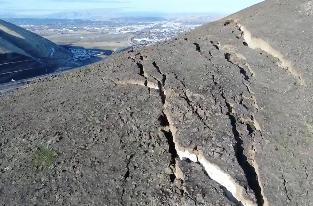
11-03-2018 Megan Anderson: Active Tectonics of Puget Sound Region
Revelations about active faulting in the Puget Sound region from geology and geophysics On Saturday, Nov. 3, you’ll have a chance to learn all about the Active Tectonics of the Puget Lowland in a lecture by Megan Anderson. In the early-2000’s, only a few active faults were known to exist in the Seattle urban area and greater Puget Lowland. Since the advent of LiDAR, geologists have put this tool to use in understanding where active faults are lurking, just under the surface of our cities and towns, and exactly how likely they are to create damaging earthquakes. Another such tool… Read more11-03-2018 Megan Anderson: Active Tectonics of Puget Sound Region
2018-06-16 Paul Loubere: Bluff Talk & Walking Guide
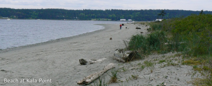
Field trip, Kala Point to Fort Townsend On June 16, 2018, Paul Loubere conducted a 75-minute indoor seminar in the morning and then led a low-tide 1.5-mile beach walk at Kala Point focusing on depositional environments, sediment properties, and modern coastal processes. 45 persons attended the seminar, and about 35 participated in the beach walk, with bag lunches at Fort Townsend State Park. A brief field guide keyed to locations along the bluff can be downloaded by clicking here. About the Speaker Paul is a retired Distinguished Research Professor who has been instrumental in forming and managing our Geology Group…. Read more2018-06-16 Paul Loubere: Bluff Talk & Walking Guide
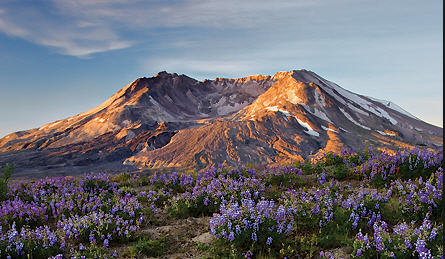
2018-07-27 Willie Scott: Mount St. Helens Field Trip
Field Trip July 27 – 29, 2018: Great Success and Photos We had 30 participants for this 3-day trip to Mount St. Helens to observe the effects of the May 1980 eruption and see evidence for older eruptions going back 250,000 years. Willie Scott (ex-USGS at CVO), Jeff Tepper, and Michael Machette led the trip (for details, click here). This trip involved driving your own car and some hiking, some on steep trails. To see a collection of photos by the participants, click here.