01-20-2018 Brandy Rinck: Geoarcheology

About the Talk

Geoarchaeology in Washington: Hidden Landforms and Buried History

Brandy Rinck presents the multi-disciplinary approach that uses methods and techniques from geology, geography, and other Earth science fields to study archaeology. This presentation considers how geoarchaeology applies to the field of cultural resources management in Washington State through example project descriptions and archaeological site accounts from the north coast of the Olympic Peninsula, the Puyallup River delta front, and the Chehalis River basin.

Archaeological sites on the Olympic Peninsula are often unique in type and some contain evidence of the first people to arrive in the region after the Last Glacial Maximum. This presentation includes a brief overview of current theories on human migration and initial occupation of the area. The presentation will include artifact and site photographs. Replica stone tools and stone tool byproducts will be available for attendees to handle at the end of the talk.

The end goal of this presentation is to explore the archaeological sensitivity of western Washington through the lens of geoarchaeology in order to understand why different depositional environments carry a diverse potential for encountering buried cultural materials at variable depths. When utilized by planners and developers, geoarchaeological data can focus archaeological field survey efforts and plan future project ground disturbance in order to increase efficiency and decrease costs.

About the Speaker

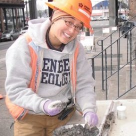
Brandy is a geoarchaeologist with King County Parks and Recreation in Renton, WA. She got degrees in Anthropology and Geology at SUNY Geneseo, followed by an M.A. in Geoarchaeology at Boston University. Ten years ago, Brandy moved to the Pacific Northwest to work in the field of Cultural Resources Management for a private firm in Seattle. She is extremely active in a number of Geology and Archeology groups in Puget Sound.

05-08-2010 Scott Burns: Wine Geology

About the Talk

Terroir of the Pacific Northwest:  A Scientific Wine Tasting

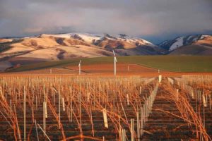
If you’ve ever wondered why wine tastes differently grown in one region over another, it may very well be due to the terroir (pronounced tair-wah)—a French term describing the geology, soils, and climate of a region which influence a grape varietal’s quality and contributes to the personality of the wine.

Our host for Terroir in the Pacific Northwest: A Scientific Wine Tasting is Dr. Scott Burns. This fundraising event is will be held at the USO Hall at Fort Worden State Park and sponsored by the Port Townsend Marine Science Center’s (PTMSC) Geology Group.

For many years, our geology study group has explored a variety of topics and this is one that will fascinate both scientists and wine aficionados alike, said Anne Murphy, executive director for the PTMSC. “We’re pleased to welcome Scott Burns to Port Townsend.”

With his perspective as a professor of geology at Portland State University, Dr. Burns’ presentation and wine tasting will address the terroir of the Columbia and Willamette River Valley appellations in Washington and Oregon respectively through the geology of each region, then compare and contrast two wines from each of those areas.

About the Speaker

Dr. Burns has taught geology for nearly 35 years with a specialization in soils, geomorphology, and regional geology. Terroir is one of Scott’s many passions; his presentations are hugely popular with wine enthusiasts, cooks, and geologists.

.

03-31-2018 Tom Badger: Landslide Hazards

About the talk

Geology, gravity, and growth: the risky business of landslide hazards in Washington

Landslide hazards abound in Washington State. They impact our shorelines and rivers, forests, infrastructure, homes, and livelihood; and on rare occasions, they result in loss of life. Tens to hundreds of millions of public dollars are spent annually in Washington State to mitigate for these impacts. Some of the better known hazard areas for frequent and/or large-volume landslides are associated with the glacial deposits of the Puget Lowland, the marine sedimentary rocks of the Olympic Peninsula and Willapa Hills, and the basalt-sedimentary interbed sequences of the Yakima Fold Belt.

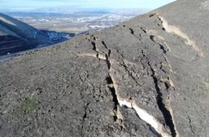
Proactive response to a particular hazard is driven by the recognition of potential environmental and societal consequences and imminence (predictability) of occurrence. The latter factor can be difficult to characterize, recently exemplified by the Rattlesnake Ridge landslide near Yakima. More often, landslides unexpectedly happen and society responds reactively. Despite the human tragedies associated with these events, notable historical landslide events in Washington, such as the 1980 Mt. St. Helens eruption, the 1983 Lake Whatcom debris flows, the 1996-7 winter events, and the 2014 SR 530 (Oso) landslide, generated high-value societal benefits. These include the implementation of forest practice rules for timber harvest and road-building, professional licensure of geologists, risk-management programs for public and private infrastructure, streamlining of emergency management procedures, landslide hazard mapping, and scientific advancement.

About the Speaker

Tom Badger is a retired engineering geologist for the Washington State Department of Transportation (WSDOT). He shared thought provoking images including an example of the Rattlesnake Ridge Landslide south of Yakima and why predictions are challenging.

Tom Badger in the news:
Seattle Times Jan. 2018 Geologist warns Yakima area landslide could be worse than officials expect … “how hard it is to predict the behavior of a massive, unstable pile of rock and dirt,” said Tom Badger

Seattle Times Feb. 2010 about Naches slide