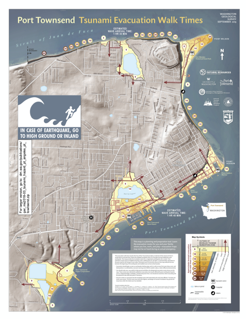
The Department of Natural Resource’s Geological Survey has released a series of Tsunami Evacuation maps for coastal areas of Washington. The Port Townsend map (2019) prints as a large poster, but we’ve made a smaller version that you can download here. Take a look and find your evacuation route if a tsunami is approaching. If its from the Big One (M 8-9) on the Cascadia Subduction Zone, you’ll have nearly two hours of response time; if its from a local crustal earthquake on the Whidby-Camino fault zone, if could be just minutes before it arrives on our beaches and bays. Get to high ground!


