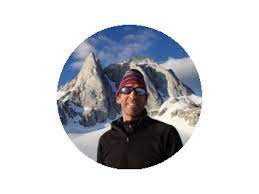
Scott Burns is a Professor Emeritus of Geology and Past-Chair of the Dept. of Geology at Portland State University where he just completed his 28th year of teaching. He was also Associate Dean of the College of Liberal Arts and Sciences at P.S.U. from 1997-1999. Scott has been teaching for 48 years, with past positions in Switzerland, New Zealand, Washington, Colorado and Louisiana. Dr. Burns specializes in environmental and engineering geology, geomorphology, soils, and Quaternary geology. Scott has won many awards for outstanding teaching, the most significant being the Faculty Senate Chair Award at Louisiana Tech University in 1987, the Distinguished Faculty Award from the Portland State Alumni Association in 2001, and the George Hoffmann Award from PSU in 2007. Based on his national leadership performance Scott was chosen to be a fellow of the Geological Society of America (2004) and a fellow with the Kellogg National Fellowship Program (1990 – 1993). He was president of the Downtown Rotary Club of Portland, Oregon’s oldest and largest Rotary club in 2009. Scott is a 6th generation Oregonian who grew up in Beaverton and is very happy to be “home” after a 25 year hiatus! He actively helps local TV, radio stations and newspapers bring important geological news to the public. Scott enjoys all sports, especially basketball, running, skiing, hiking, swimming, tennis, and golf. (From Smithsonian Journeys)
Scott has been a frequent and generous speaker for the Quimper Geological Society. He conducted Terroir lectures three times (2010, 2015 and 2021), which have been tremendous fundraisers for us. (Updated Oct. 2021)
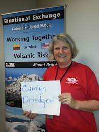 Carolyn Driedger is a Hydrologist and Outreach Coordinator at the U.S. Geological Survey in Vancouver Washington. Her science career began with research on glaciers and glacier-related hazards principally at Cascade Range volcanoes, and at Columbia Glacier Alaska. Carolyn witnessed the May 18, 1980 catastrophic eruption of Mount St. Helens and participated in the initial news media response. This event set the course for several fascinating projects that crossed science disciplines, and it provided a front-row seat for observation and reflection upon the role of scientists in society. Carolyn learned that scientists must use the same degree of creativity and care with public communication that they use with scientific endeavors. Now, as CVO’s Outreach Coordinator, she works in partnership with public officials, emergency planners, media, park interpreters, and educators to advance the cause of eruption preparedness. Some earlier career choices have informed current work, including several years of teaching in a US public school and private school in Kathmandu Nepal, and working for the National Park Service.