The Lecture
Nevado del Ruiz (Colombia) and Mount Rainier (US) exist a hemisphere apart, but they both project similar hazards for communities downstream. Central to their stories is the development and continued presence of weak and collapse-prone hydrothermally altered rock, and perennial covers of glacier ice and snow. Slopes of both volcanos are mantled by loose rock debris that can be remobilized to initiate lahars. At both volcanoes, five major glaciofluvial rivers flow down narrow valleys to lowland areas that support large human populations. More than a 150,000 persons live in areas at risk of lahars that could emanate from Rainier. Thirty-six years ago, Colombia’s Nevado del Ruiz initiated a lahar that killed an estimated 25,000 people. We examined hazards at both volcanoes; discuss international synergies for risk reduction, progress and challenges, and review some practical lessons learned about community risk reduction.
The Speaker
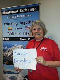 Carolyn Driedger is a Hydrologist and Outreach Coordinator at the U.S. Geological Survey in Vancouver Washington. Her science career began with research on glaciers and glacier-related hazards principally at Cascade Range volcanoes, and at Columbia Glacier Alaska. Carolyn witnessed the May 18, 1980 catastrophic eruption of Mount St. Helens and participated in the initial news media response. This event set the course for several fascinating projects that crossed science disciplines, and it provided a front-row seat for observation and reflection upon the role of scientists in society. Carolyn learned that scientists must use the same degree of creativity and care with public communication that they use with scientific endeavors. Now, as CVO’s Outreach Coordinator, she works in partnership with public officials, emergency planners, media, park interpreters, and educators to advance the cause of eruption preparedness. Some earlier career choices have informed current work, including several years of teaching in a US public school and private school in Kathmandu Nepal, and working for the National Park Service.
Additional Resources
Barry Voight 1990, The 1985 Nevado del Ruiz volcano catastrophe: anatomy and retrospection
Driedger et al 2020, Leveraging lessons learned to prevent future disasters—insights from the 2013 Colombia-US binational exchange
Driedger et al 2020 Ten Ways Mount St. Helens Changed Our World—The Enduring Legacy of the 1980 Eruption
Perry et al 2016 Get your science used—Six guidelines to improve your products
Pierson, Wood, Driedger (2014) Reducing risk from lahar hazards: concepts, case studies, and roles for scientists