About the Talk
Geomythology: The Quest for Scientific Explanations of The Great Flood and Other Mythical Catastrophes
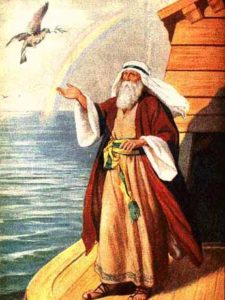 Myths from many cultures around the world contain descriptions of phenomena or events that bear a striking resemblance to natural disasters including floods, earthquakes, volcanic eruptions, tsunamis, and meteorite impacts. Geomythology is an emerging discipline that combines geology, archaeology, mythology, and history to investigate the possibility that some of these mythical “stories” may in fact be garbled accounts of actual events that occurred in the distant past. There is strong evidence that some myths originated over 7,000 (and possibly up to 40,000) years ago. Thus a major challenge in geomythology is to see through the changes these stories underwent as they were passed down orally over hundreds of generations. In this talk we will examine the origins of the Great Flood story, analyzing the Biblical and Mesopotamian versions as well as possible linkages to catastrophic flooding of the Black Sea. We will also discuss Plato’s account of the sinking of Atlantis and several stories that appear to have originated with earthquakes and tsunamis. Included among the latter are legends from the Pacific Northwest that feature battles between the Thunderbird and the Whale, a motif now recognized as a tsunami metaphor.
About the Speaker
Jeff Tepper is a Professor and Chair of the Geology Department at the University of Puget Sound. He received his AB from Dartmouth College and his MS and Ph.D. from the University of Washington, where he studied the origins of granites in the North Cascades. After teaching on the east coast for ten years, he joined the faculty at Puget Sound in 2001. Dr. Tepper’s research uses geochemistry to investigate geologic questions. He and his students are currently studying the Eocene magmatic and tectonic history of the Pacific Northwest, the environmental history of the Puget Sound area as recorded in lake sediments, and the behavior of heavy metals in sediment.
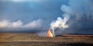
 While he was at HVO, Kilauea erupted at three areas. Several times, 2,000-ft-tall lava fountains spewed from the east rift zone, at a site later named Mauna Ulu (Hawaiian: growing mountain). Elsewhere, so-called “curtains of fire” danced from long cracks on the floor of Kilauea’s summit caldera. And for only the fourth time in Hawaii’s historic record, lava emerged from a fissure along the southwest rift zone.
 About the Speaker