About the Talk
Ian Miller of Washington Sea Grant (University of Washington) will discuss Coastal Response to Dam Removals on the Elwah River: Present and Future at 4 pm on Saturday, January 12 in Port Townsend as part of the Jefferson Land Trusts Geology Group Lecture Series.
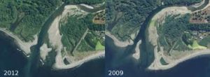
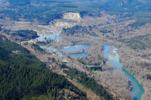
 For nearly a century, two dams on the Elwha River disrupted the flow of sediment from the Olympic Mountains to the Strait of San Juan de Fuca, contributing to the erosion of the Elwha River delta just west of Port Angeles and altering coastal habitat both to the east and west.
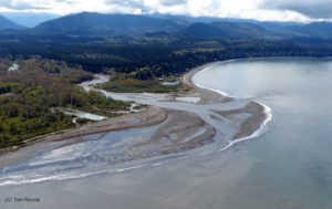
Removal of the dams was completed last fall, and now the river is free to flow in its natural course. Already, salmon have returned to the river and are starting to spawn. Researchers from a variety of state and government agencies are tracking how the river’s ecosystem responds with millions of tons of sediment make their way north to the coast.
Ian’s talk will provide a “status report” on how the coastal zone is responding to the removal of the dams and rapid erosion of the sediment impounded behind them.
About the Speaker
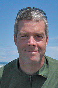
Based at Peninsula College, Dr. Miller focuses on research, education, and outreach on natural coastal hazards on the Olympic Peninsula, including hazards due to climate change, tsunamis, and chronic erosion. He has a bachelor’s degree in marine ecology from Western Washington University and earned his doctorate in oceanography from the University of California—Santa Cruz in 2011.
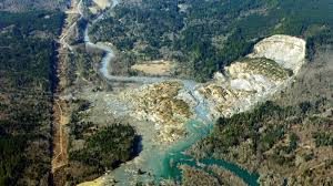
 There are some unique geologic aspects of the Oso Landslide that will likely offer some valuable lessons regarding landslide risks and help inform policy regarding landslides. This talk will attempt to put the Hazel/Oso landslide in perspective with other landslide hazards in Washington State. While the Hazel/Oso Landslide may hold some technical and policy lessons, information on other landslide sites in Washington State will be presented, including some landslides in Jefferson County. Part of the presentation will discuss how landslide risks and public policy meet and various approaches to landslide hazard risk reduction.