2024-11-16 Megan Anderson – Siletzia’s influence on the Seattle Fault

Quimper Geological Society

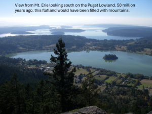
 The Puget Lowland of Washington State contains several potentially dangerous seismic faults, including the Seattle fault, which runs south of downtown Seattle. To accurately assess the earthquake hazard in this region, we need to understand the architecture and geologic history of the rocks that host these faults, deep below the Puget Lowland. Geologists do this by using small changes in Earth’s gravity and magnetic fields to create images of the Earth’s subsurface. These rocks formed in a subduction zone 50 million years ago when a set of volcanic islands, similar to modern-day Iceland, collided with the edge of North America. This added a mass of rock, called Siletzia, to the continent. Megan showed us that as the islands piled up, they broke and folded into mountain ranges. South of Seattle, Siletzia was pushed up and over ancient North America, whereas to the north, Siletzia was pulled down and under the continent. She argued that a tear in Siletzia between these two zones eventually became the proto-Seattle fault, which provides a story for the Seattle fault’s origin and earliest history. Her images provided information that can improve models of ground shaking from future earthquakes affecting the greater Seattle urban area. *AGU abstract below.
 Megan Anderson is an earthquake geophysicist at the Washington Geological Survey. Megan spent her early years in Kent, WA, during which the eruption of Mt. St. Helens spurred her fascination with geology, which was her major at Carleton College in Minnesota. She studied subduction processes and earthquakes in South America for her Ph.D. at the University of Arizona. She has studied numerous tectonic regions of the world but has always made her way back to the Pacific Northwest because there is so much left to discover. She taught for ten years at Colorado College, dragging her students and equipment across the country to do research in Washington. She is now firmly planted in Olympia as home.
 Professor Harold Tobin holds the Paros Endowed Chair in Seismology and Geohazards at the Department of Earth and Space Sciences at the University of Washington. He also serves as the Director of the Pacific Northwest Seismic Network and Washington’s State Seismologist. Despite that title, his scientific roots are in subduction zone geology and the structure of plate boundary fault zones. With a B.S. in geology and geophysics from Yale University and a PhD from University of California, Santa Cruz, Harold has held faculty positions at New Mexico Tech and the University of Wisconsin-Madison prior to moving to Seattle in 2018. His first taste of subduction geology was as an undergraduate field assistant in the Olympic Mountains in 1987, and after 30 years of offshore and onshore research in Japan, Alaska, New Zealand, Costa Rica, and California, he has come full circle to explore the core rocks of the Olympic mountains.
Darrel Cowan discussed the evolution of hypotheses about the large-scale coastwise displacements of tectonic elements or terranes along the western margin of North America. He presented the geologic evidence he published in 1982, which links Vancouver Island with southeast Alaska. The still-contentious Baja British Columbia hypothesis, developed in the early 1980s, was based entirely on paleomagnetic data.
This IN-PERSON ONLY lecture was free and open to the public. The lecture was recorded and posted shortly after the presentation, as are all our events since 2020.

Darrel Cowan is Professor Emeritus in the Department of Earth & Space Sciences at the University of Washington. He refers to himself as a field structural geologist. Since 1974, Darrel has spent his career educating geologists in tectonics and structural geology. Darrel is a west coaster, originally from southern California. He graduated from Stanford in 1966 and finished his PhD in the Franciscan subduction complex there in early 1972. Darrel’s research projects and those of his graduate students have investigated structural and tectonic problems in the Pacific Northwest, including southwestern British Columbia and Vancouver Island, southern Alaska, Japan, and the northern Apennines and Sicily in Italy.