2022-10-15 Erin Donaghy, Revisiting stratigraphy of the Eocene to Miocene sedimentary peripheral rocks on the Olympic Peninsula, Washington

The role of oceanic plateau collision in the geologic development of the Olympic Peninsula: testing geologic connection between Wrangell-St. Elias (AK) and Olympic (WA) National Parks.

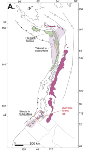
The Pacific Northwest (PNW) has a long geologic history of seismic activity. Recent studies suggest the PNW experienced a collision ~50 million years ago (Ma, early Eocene) which resulted in an enormous oceanic plateau attaching itself to the west margin of the continent. That plateau is known fondly, as Siletzia.

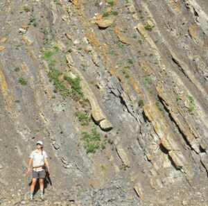
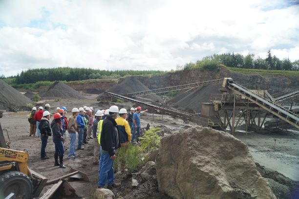
On October 15, 2022, Erin Donaghy discussed what occurred after the accretion of Siletzia. She described the interbedded siltstone and sandstone turbidites in the deep marine environment. These rock strata are known as the peripheral sequence of the Olympic Peninsula and are thought to be part of the regional Tofino-Juan de Fuca forearc basin. These strata are divided into two distinct sections by the Lower Elwha fault (hanging wall = basalts (Silezia) and overlying sedimentary rocks; footwall = younger (Eocene to Miocene peripheral rocks). She explained how the correlation of Eocene deposits on the north side of the Olympic Peninsula and those on the south side is still not firmly established.

Erin and colleagues have been using new mapping and zircon geochronology of the north Olympics’ Blue Mountain Unit (BMU) to re-evaluate the basin formation in the context of Siletzia accretion. She explained how these new data suggest that continentally derived sediment flooded into the basin immediately before and after a major period of basaltic volcanism. Erin provided new interpretations of how the BMU reflects a period of marginal rifting after accretion. She also discussed the depositional setting for the Aldwell, Hoko River, and Makah Formations, which are younger than the docking event of Siletzia.

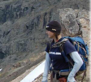
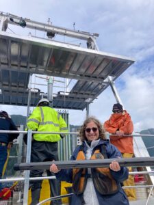
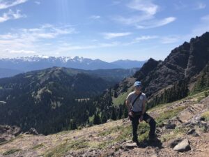
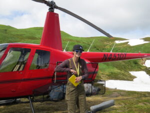
Erin and colleagues conducted more sampling this past summer (2022) in Wrangell-St. Elias National Park, AK, and the Olympic National Park, WA (September 2022). Ongoing high-precision uranium-lead zircon geochronology of interbedded volcanic rocks will provide more precise depositional ages for the sequences. Geologists think the Yakutat terrane, currently colliding with southeastern Alaska, may have originated as part of the Siletzia plateau offshore the PNW. She discussed the significance of the changing provenance of Eocene sedimentary rocks in the Tofino-Juan de Fuca basin within the context of a rifting oceanic plateau, migrating triple-junctions, and the possible northward translation of the Yakutat terrane during this time.


The Speaker:

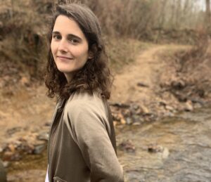
Erin Donaghy is a sedimentologist and field geologist interested in studying basins that form along active convergent margins.

2012 – B.S. in Geology, Bucknell University (Lewisburg, PA); her initial interests included environmental geology and did aqueous geochemistry, before switching to Geology and wrote a thesis in sedimentology with Dr. Jeff Trop.

2015 – M.S. degree in Geology, Northern Arizona University (Flagstaff, AZ); she worked with Dr. Paul Umhoefer and studied the Eocene basin evolution of the Chumstick basin in central Washington. During graduate school she took time off to complete an internship with ConocoPhillips in Anchorage, AK and studied the structural and depositional evolution of basins offshore of the North Slope.

She then gained three years of professional experience as an exploration geologist in the energy industry, providing her the opportunity to study basins around the world. This included Deepwater Gulf of Mexico Exploration and Operated Wells, and the Global New Ventures Conventional teams.

current – PhD, Purdue University, Department of Earth, Atmospheric, and Planetary Sciences (West Lafayette, IN); her passion for teaching, mentoring, and research drove her to return to graduate school in Geology. Erin works with Dr. Michael Eddy and Dr. Kenneth Ridgway and uses the sedimentary record to tackle large-scale tectonic questions. She integrates both traditional field mapping methods and analytical methods in my research to constrain the temporal and lateral variations in depositional environments and provenance within sedimentary basins. This helps her piece together a detailed basin history in context of high-precision chronostratigraphy. She skillfully involves numerous undergraduates in both field and analytical lab work and mentored them through individual research projects where they have the opportunity to present at national level conferences.

Erin is well published, a great speaker, and is a geologist to follow into the future!

2022-11-19 Karl Wegmann, Recent advances in understanding the Lake Crescent fault system

Earthquakes, Rock Avalanches, Displacement Waves, and Turbidites: The Amazing Holocene Sedimentary Record from Lake Crescent, Clallam County, Washington


The Lake Creek–Boundary Creek fault zone lies below Lake Crescent, a deep, glacially carved lake on the north side of the Olympic Peninsula, west of Port Angeles. This fault zone includes a system of structures that reveals at least 56 kilometers (35 miles) of late Pleistocene to Holocene surface rupture. New data from the sediment cores taken from the lake’s bottom document four ruptures along the fault zone. Those seismic events triggered several large rockslides along the slopes adjacent to ancestral Lake Crescent that split the lake into two:  Lake Crescent and Lake Sutherlund. After this separation, each lake established its own drainage system to the Strait of Juan de Fuca. Over time, the salmonids in each lake have developed genetic differences that now make them distinct new species.

Karl explained the tools and processes he and his colleagues used to understand the past ~7200 years of lake history by examining sediment cores. He also shared their thoughts on the calculated risk of a ~Mw 6.5-7 earthquake in the next 100 years… and the outcome of salmon speciation.

For more information related to this talk, please review this website –>


The Speaker

Karl Wegmann is a local guy! Well, he grew up on the north side of the Olympic Peninsula, where his parents still hike the trails. He received his Ph.D. (2008) Earth and Environmental Science, Lehigh University, Bethlehem, PA; and M.S. (1999) Earth and Planetary Sciences, University of New Mexico, Albuquerque, NM; starting college career with a B.A. (1996) Geology, Whitman College, Walla Walla, WA; and best of all he graduated from Port Angeles High School (1992).

Karl currently is an Associate Professor of Geology at the Department of Marine, Earth, and Atmospheric Sciences, North Carolina State University (2015-present) and is Faculty Fellow – Center for Geospatial Analytics there as well (2017 – present).

His previous work as a geologist, no doubt, helps his students become geologists with practical experiences. He worked as a geologist with Washington State Geological Survey (1999-2004). He has more than 70 research publications, including peer-reviewed journal articles, geologic maps, and landslide hazard assessments. Karl is fully engaged in academia and is Primary Mentor/Advisor for 8 Ph.D. and 7 M.S. graduate students at N.C. State who have conducted research on the Olympic Peninsula of Washington State, Colorado, New Mexico, North Carolina, Oregon, Greece, Mongolia, and Mars; he is also co-creator of the HazMapper.org platform for global, open-source, and publicly available natural hazard detections via cloud computing. And to top life off, Karl has just finished the post of the 2021-2022 Chair of the Quaternary Geology and Geomorphology Division of the Geological Society of America.

2016-06-11 Field trip to two basalt quarries & photos

2016 Field Trip to the New Shine and Penny Creek Basalt Quarries

Saturday, June 11, 2016; 8:30 am – 2:30 pm

Leaders: Jeff Tepper, UPS Geology Professors Ken Clark and Jeff Tepper; Carol Serdar Tepper, Geologist

Some things we’ll see and discuss: Regional geology of the Crescent Basalt
Where and why basalts outcrop in the area
Basalt petrology, mineralogy and weathering
Basalt quarry operations and economics of production

Trip leaves from Chimacum High School, travels to Shine Quarry (Port Ludlow), then Penny Creek Quarry (Quilcene), and finishes with an overview from Mount Walker. Returns to Chimacum around 2:30 (all depending upon weather conditions).

Driving: If you are willing to be a carpool driver, please let us know your car type (van, sedan, station wagon, etc.) and how many passengers (and their gear) you can accommodate. All passenger seats must have a functioning seatbelt. Drivers will be reimbursed for gas expenses.

Cost: $10 each, BYO lunch and beverages. Hard hats supplied (or bring your own). You will receive trip details after you are registered. Trip fee is payable (cash or check) at beginning of the trip.

Note: Some hiking over uneven ground. Young children and pets are not allowed, and this will not be an ADA-accessible field trip. Bring rain gear, hat, camera, note pad and hand lens if you have one.