The Lecture
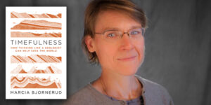
Developing and calibrating the geologic timescale — reconstructing Earth’s past from the raw rock record — is one of humanity’s greatest, but least appreciated, intellectual achievements. But as a society, we are time illiterate, lacking a sense for the durations of the chapters in Earth’s history, the rates of change during previous intervals of climate instability, and the intrinsic timescales of ‘natural capital’ like groundwater systems. This matters because environmental wrongs, social conflicts and existential malaise are all rooted in a distorted sense of humanity’s place in the history of the natural world. Thinking like a geologist can simultaneously ground us and elevate us. Paradoxically, this Earth-bound, very physical science can yield transcendent insights.
Timefulness was longlisted for the 2019 PEN/E.O. Wilson Prize for Literary Science Writing and was a finalist for the 2018 the Phi Beta Kappa Award in Science, and the LA Times Book Prize in Science & Technology.
 The Speaker
Marcia Bjornerud, Professor of Geosciences at Lawrence University in Wisconsin, is a structural geologist whose research focuses on the physics of earthquakes and mountain building. She combines field-based studies of bedrock geology with quantitative models of rock mechanics. She has done research in high arctic Norway (Svalbard) and Canada (Ellesmere Island), as well as mainland Norway, Italy, New Zealand, and the Lake Superior region. Bjornerud is a Fellow of the Geological Society of America and has been a Fulbright Senior Scholar at the University of Oslo, Norway and University of Otago, New Zealand. A contributing writer to The New Yorker, Wired, the Wall Street Journal and the Los Angeles Times, she is also the author of several other books for popular audiences — Reading the Rocks: The Autobiography of the Earth and Geopedia: A Brief Compendium of Geologic Curiosities.

