About the Talk
Terroir II—The Geology of Washington Wines
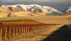 On Saturday, May 2, 2015, Geology professor emeritus and oenophile Dr. Scott Burns of Portland State University will give an illustrated lecture on the influence of geology on grapes, how they grow, and the effect on wines. This topic—commonly known as terroir—will focus on the Columbia River Basin and its geologic history. The talk will feature two local wineries that get their grapes from that region.
About the Speaker
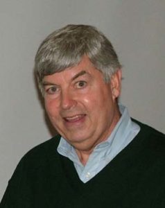
Dr. Burns has taught geology for nearly 35 years with a specialization in soils, geomorphology, and regional geology. Terroir is one of Scott’s many passions; his presentations are hugely popular with wine enthusiasts, cooks, and geologists throughout the Pacific Northwest. Scott’s previous terroir lecture in May 2010 was sold out well in advance, and this event is largely in response to many requests for an encore performance.
Our featured wineries are from the Olympic Peninsula: Camaraderie Cellars in Port Angeles, owned by Don Corson, and Lullaby Winery in Port Townsend, owned by Virginie Bourgue. These vintners will speak about their source vineyards and their wines, and they will offer a tasting of two fine wines from each winery.
This event is a fundraiser for the Jefferson Land Trust to support their work to protect local forests, farms, and wildlife habitat in Jefferson County. The lecture and wine tasting will be in the USO Building at Fort Worden on Saturday, May 2nd from 3 to 5 pm.

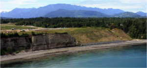
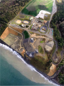 Since closure in 2007, and for about 5000 years before that, wave action at the beach site has been continuously eroding the 135-foot tall feeder bluffs. In June 2011, a small exposure of garbage from one of the seaside landfill cells was observed hanging over the edge of the bluff. Further erosion could easily have resulted in a large release of garbage onto the beach since there were only eleven to fifteen feet of native bluff between the eroded face and a 60-foot deep pit of municipal solid waste.
 About the Speaker