Revelations about active faulting in the Puget Sound region from geology and geophysics
On Saturday, Nov. 3, you’ll have a chance to learn all about the Active Tectonics of the Puget Lowland in a lecture by Megan Anderson.
In the early-2000’s, only a few active faults were known to exist in the Seattle urban area and greater Puget Lowland. Since the advent of LiDAR, geologists have put this tool to use in understanding where active faults are lurking, just under the surface of our cities and towns, and exactly how likely they are to create damaging earthquakes.
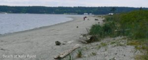
Another such tool is geophysics, which allows geologists to understand what rocks might be underfoot even when covered by soil, vegetation, and pavement. Geophysics has been instrumental in allowing us to extend our interpretations across the entire Puget Lowland. In this presentation, Megan will show just how much our understanding has grown over the last decade+ and where we are still working to characterize active faults, including places on the Olympic Peninsula near Port Townsend
The hour-long lecture is sponsored by the Jefferson Land Trust’s Geology Group and is open to the public; a donation of $5 would be appreciated to defray expenses.
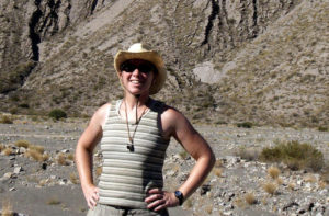
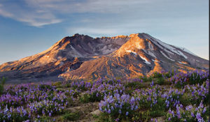
 Megan Anderson is an earthquake geophysicist at the Washington Geological Survey. Megan spent her early years in Kent, WA during which the eruption of Mt. St. Helens probably spurred her fascination with geology, which was her major at Carleton College in Minnesota. She studied subduction processes and earthquakes in South America for her Ph.D. at the University of Arizona. She has studied numerous tectonic regions of the world but has always made her way back to the Pacific Northwest because there is so much left to discover. She taught for 10 years at Colorado College, dragging her students and equipment across the country to do research here every summer, but now (as of June) has made her home at the WGS in Olympia.
 Paul is a retired Distinguished Research Professor who has been instrumental in forming and managing our Geology Group. We last had Paul on our stage in 2015 as a speaker on Rising Seas, Retreating Shorelines. Our local newspaper, the PT Leader, wrote about his presentation –