The Lecture
Hazards and Highways: Troubles for the NW Olympic Peninsula

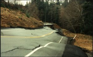
State Route 112 is the sole access road for the northwestern Olympic Peninsula and the remote communities situated along the Strait of Juan de Fuca, west of Port Angeles. Particularly unfavorable geology underlies the western half of this road and this, combined with steep topography and an exceptionally wet winter climate, make it one of the most landslide-afflicted highway corridors in the state. Landslides and lowland flooding impact travel most winters, causing short duration closures of one or both lanes and necessitating persistent maintenance efforts. On a longer cycle of years to decades, major landslide events severely damage or destroy the highway at one or more locations, resulting in closures lasting three to six months or longer. Detour options are limited to nonexistent, so communities and local businesses suffer from these closures until highway repairs can be made or floodwaters recede. Low frequency-high consequence hazards such as earthquakes and tsunamis add to the risk profile and further complicate mitigation strategies.
This presentation summarizes the results of a planning-level study commissioned by the Washington State Department of Transportation (WSDOT) that examined the geologic and hydrologic hazards that threaten this highway, conducted a comprehensive risk analysis, and provided recommendations to improve its resiliency and reduce community impacts. The study, completed in 2023, enabled WSDOT to secure a 5-yr $30 million allocation from a NOAA Climate Resiliency grant in late 2024 to proceed with initial recommendations, which are expected to begin Spring 2025.
About the Speaker
Tom Badger
Happy to leave the Midwest flatlands behind in 1981, Tom completed his BS in geology in 1983 at WWU and his MS in geological engineering at the University of Nevada Reno in 2002. He is licensed in Washington as an engineering geologist, hydrogeologist, and civil engineer. Tom worked for WSDOT for 32 years, the last five serving as chief engineering geologist, before retiring in 2016. Tom specializes in the assessment and mitigation of slope hazards, soil and rock slope engineering, and risk management for transportation infrastructure. He has published and lectured extensively on these topics, and consults part-time for the Portland-based firm, Landslide Technology.


Leigh Tucker is a post-baccalaureate student at the University of Washington working towards a Bachelor of Science in Geology. Her undergraduate honors research extended the work started by Marquis Richardson, comparing sands from the Puget Sound and the Olympic Coast to determine if the garnets came from the same source. She recently interned with the USGS Earthquake Science Center on the development of an automated earthquake rupture mapping tool using machine learning and unmanned aerial vehicles. Leigh plans to pursue a graduate degree in volcanology after completing her BS in June 2025. When she isn’t studying, you can find Leigh baking, hiking, or reading to her granddaughter.
Marquis Richardson graduated from the University of Washington with a BS in Earth and Space Sciences: Geoscience. During his time there he investigated index mineral inclusions in garnet sands from Ruby and Rialto Beaches on the Olympic Coast (Washington). After graduation he hiked the Pacific Crest Trail and worked as a staff geologist for a geotechnical consulting firm before moving to restoration ecology work. He will be hiking the Continental Divide Trail over the summer of 2025 with plans to pursue graduate school after he returns.
5/3/2025 (PM) Carrie Carpenter from Whidbey Island wrote an email asking about sand on the beach close to where she lives: “i live on whidbey…East Point in Saratoga Passage… garnet sands?”