If you live in the Puget Sound, you might want to look at the attached U.S. Geological Survey shake map and shake scale models resulting from a 7.4 event on the South Whidbey Island Fault. The full article with a description of projected damages is found at https://earthweb.ess.washington.edu/gomberg/ShakeMap/ShakeMaps.html
Category: Maps
2023-10-19 Great Shake Out
Many citizens will be practicing for the Big One on October 19th. Here is shake map and shake scale models resulting from a 7.4 event on the South Whidbey Island Fault. Full article with description of projected damages is found at https://earthweb.ess.washington.edu/gomberg/ShakeMap/ShakeMaps.html

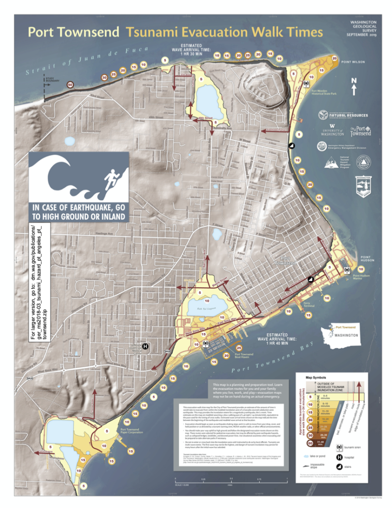
2020-02-29 Tsunami Evacuation Walk Time Maps

The Department of Natural Resource’s Geological Survey has released a series of Tsunami Evacuation maps for coastal areas of Washington. The Port Townsend map (2019) prints as a large poster, but we’ve made a smaller version that you can download here. Take a look and find your evacuation route if a tsunami is approaching. If its from the Big One (M 8-9) on the Cascadia Subduction Zone, you’ll have nearly two hours of response time; if its from a local crustal earthquake on the Whidby-Camino fault zone, if could be just minutes before it arrives on our beaches and bays. Get to high ground!
