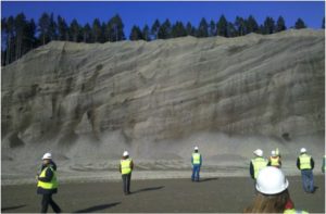
2014-08-02 Michael Polenz: Central Quimper Peninsula Field trip

About the Field Trip

Geology of the Quilcene to Center Area (Center Road)

Leaders:  Michael Polenz*, Trevor Contreras*, Harley Gordon*, Ian Huber*, Jeff Tepper, and Carol Serdar Tepper

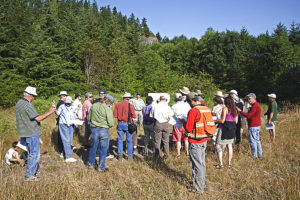
The purpose of this field trip is to review the geology of the southern part of the Quimper Peninsula (sites between Chimacum and SR104 between Discovery Bay and the Hood Canal bridge), which has been mapped recently by geologists* at the WA Dept. of Natural Resources.  The main focus is on the Tertiary bedrock of the peninsula and the history and deposits of late Pleistocene glaciation, which created most of the present landscape.

The trip will start at 8 am at the Chimacum High School parking lot, where we will assemble our caravan of carpoolers.  Minimizing the number of cars is critical since some stops will be along narrow road margins.  There will be as many as eight stops, so it’s a full and arduous day with some hiking over uneven ground.  You should bring a bag lunch and other personal items (rock hammer, hand lens, sunscreen), but we will provide water and beverages for lunch.  The trip will culminate with an open-ended stop for cider, wine, bread, cheese, and chats at the Finnriver Farm (@ 5 pm), one of the Jefferson Land Trust’s farm partners.

We must limit the participants to 25 so don’t delay if you want to be on this rather hard-core geology field trip.  Cost of the trip is $20, which we’ll collect on the morning of the trip.

10-19-2013 Kathy Troost: Jökulhlaups

About the Lecture

Jökulhlaups from Glacial Lake Puyallup, Pierce County, WA

Kathy Troost will present a lecture for the Jefferson Land Trust’s Geology Group entitled Jökulhlaupsfrom Glacial Lake Puyallup, Pierce County, WA.

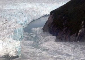
For decades, geologists thought that normal surface flooding caused the surface channels and cobble deposits in Pierce County. However, these deposits are the result of repeated jökulhlaups (glacial outbursts) from Glacial Lake Puyallup during the retreat of the Vashon Ice Sheet about 13,500 years ago.

(Photo from https://commons.wikimedia.
org/w/index.php?curid=676643)

The affected landscape shows evidence of large outburst floods, such as kettle lakes from the grounding of large ice blocks, large-scale bed forms, waning-flow deposits with bogs, and thick deltas at the coast. As such the floods have shaped much of the landscape in Pierce County.

About the Speaker

Kathy Troost is a Licensed Geologist with 34 years of experience in geological research and investigations focused on the Pacific Northwest. Kathy has published many geological maps and papers about Quaternary geology and deposits. She teaches at the University of Washington in Seattle, has her own consulting company, is currently the President of the Northwest Geological Society, and will complete her doctorate at UW later this year.

2013-09-14 Jim Aldrich: Development of Olympic Mountains

About the Field Trip: Structural Development of the Olympic Mountains

2013 – Sept. 14-15

Read/download field guide – 16 pages…

Read/download color photo summary of the field guide…

Jim Aldrich, who has been working on a geologic investigation of the structure geology and tectonics of the mountains for three years, was the trip leader.

Original announcement: The trip will originate and end at the Olympic National Park visitor center on the south side of Port Angeles. The trip starts at 9:00 am Saturday, September 14. The first day we will be stopping at outcrops of the Olympic Subduction Complex (OSC) Lower unit on the Pacific Coast and the oldest strata of the Coast Range Terrane on the north flank of the mountains. We will stay at a motel in Port Angeles that night. The second day we will be examining outcrops of the OSC Upper unit in the core of the range and the upper strata of the Coast Range Terrane along Hurricane Ridge Road. The longest walks to outcrops are two that are about 1/4 mile down a moderate grade. All other stops are at outcrops across a road. The field trip will end by 5 pm September 15th. Costs: There is no trip fee. Participants will have to pay for their own motel room, or the cost to share a room if they are willing to do that, and meals.

This field trip includes stops to observe and hear about the geology of the three major rock sequences of the Olympic Mountains – from the Pacific Coast to the core rocks on Hurricane Ridge.

Read more about Jim Aldrich, the leader…


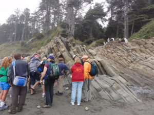
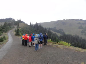
Discussion of Hurricane Ridge fault where it cross Hurricane Ridge Trail. Field trip participants gather around to get closer look at Beach 4 primary sedimentary structures

Read archived announcement of this field trip…

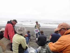
Jim discussing turbidite deposits and deformation at Beach 4
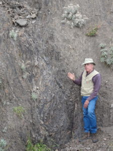
Jim discusses the nature of deformation in eastern Olympic Mountains accretionary complex.