2022-11-02 KPTZ Nature Now Interview, Part 2—Walk to the Rocks field trip

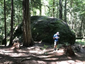
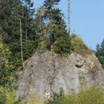
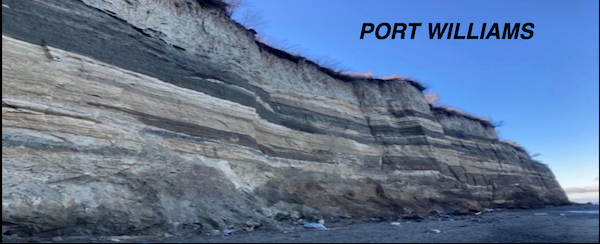
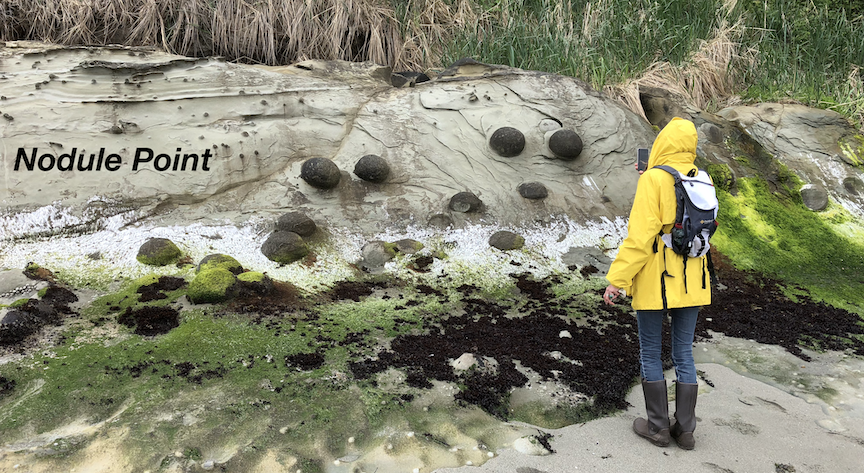
Nan Evans of KPTZ and local geologists, Jeff Tepper and Michael Machette, explore two significant rocky outcrops in Eastern Jefferson County – Tamanowas Rock and Peregrine Rocks, both just northwest of Chimacum.  To download the field trip guide that this interview was based on, click here.

The interview is for Nature Now, a weekly radio broadcast on KPTZ 91.9 MHz. Because Nan got so many interesting tidbits, the interview will be broadcast in two parts and each will be recorded as MP3s and be available if you can’t hear the broadcasts:

Show #587: Hard Rock Geology in Eastern Jefferson Country, Park 1
Broadcasts Oct. 5 at 12:30 PM, Oct. 7 at 5:30 PM, Oct. 8 at 12:30 PM

Listen in to learn how Tamanowas Rock was formed, what it can tell us about the ancient landscape of our region, why Tamanowas Rock is important to indigenous peoples, and what is being done to protect it. The recorded broadcast is available on  KPTZ’s Nature Now page.

Show #591: Hard Rock Geology in Eastern Jefferson Country, Park 2
Broadcasts Nov. 2 at 12:30 PM, Nov. 3 at 5:30 PM, Nov., 5 at 12:30 PM

Exploring Peregrine Rock, a glacial erratic, gives listeners a chance to consider the impacts of glaciation on Eastern Jefferson County and to ask just where did the rock come from and how did it get here?

2022-07-08 Walk to the Rocks Field Trip

Geology of Tamanowas  Rock and Peregrine’s Rock, Chimacum, WA

Tamanowas  Rock

On Friday, July 8, 2022, five of our QGS geologists led a 4-mile, 4-hour hike  from HJ Carroll County Park near Chimacum to the Tamanowas Rock Sanctuary, then up on top of Tamanowas Ridge to see Peregrine’s Rock.

This 4-mile hike is vigorous, steep, and rough in parts and is tailored to agile citizen scientists who are already knowledgeable about geologic principles and vocabulary.

Subjects discussed on the field trip include the glacial history of the Quimper Peninsula (specifically Chimacum Valley), glacial erratics on the Peninsula, and the geology of the underlying Eocene volcanic rocks that form Tamanowas Rock. This feature is a special part of the story and a sacred place of the S’Kallum people.

Tamanowas Rock is the remnant of an explosive volcano that erupted about 43 million years ago.  It is comprised of adakite, an unusual type of lava that forms under anomalously high temperatures when a subducted oceanic plate starts to melt.

Conversely, Peregrine Rock is a glacial erratic named by Eric Nagle, a participant in our Great Erratic Challenge two years ago. It currently is the largest erratic we have found on the Quimper Peninsula (see Great Erratic Challenge under Resources in the menu bar.

The field trip guidebook, which is 13 pages and well illustrated (pdf), was edited after the field trip and is now available. There is a 2023 version (June 2023), see more recent field trip notice.

2021 Summer Geology Beach Guides–North Beach, Port Williams, & Nodule Point

2021 Summer—Three Geology Beach Walks and Detailed Guides

We led three different beach walks where you can learn more about the geology and sediments that form the bluffs and supply the beaches. Each trip ran twice.  Because of parking and logistical difficulties, attendance was limited to about 20 participants for each trip. Field trip guides are available for downloading.  This are preliminary and dynamic; we may update them as more information becomes available.

FORT WORDEN—NORTH BEACH, PORT TOWNSEND

  • Where: Meet at Fort Worden in the parking pad south of Battery Kinzie for a two-hour walk. State parks pass required to park here.
  • What: On the one-mile walk west towards North Beach county park, we’ll see a wide variety of glacial deposits including outwash and marine sediments, a peat layer, a “buried” forest, and glacial erratics on the beach. All are well exposed in a steep bluff at sea level. Generally, we walk up section (through younger deposits to the west). There are various return routes.
  • Leader: Kitty Reed, retired geologist, and several assistants.
  • For: Persons with limited geology background, easy walking across some bouldery section of beach.
  • To download the guide, 2021 NB bluff guide final.

PORT WILLIAMS, SEQUIM BAY

  • Where: Meet at Port Williams, NE of Sequim for a two-hour walk. Carpooling recommended; small parking lot at this county park.
  • What: We’ll see glacial deposits, including Vashon till and Possession drift, various outwash deposits, and locally derived alluvium of the Dungeness River. All are well exposed in a steep bluff at sea level.
  • Leader: Kitty Reed, retired geologist, and several assistants.
  • For: Persons with geology background. This is the least known of the three areas we’ll visit this summer. We invite active discussion. Generally easy walking
  • To download the guide, click this link (2021 Port Williams walkers guide).

NODULE POINT, MARROWSTONE ISLAND

  • Where: Meet at the East County Beach Park,  NE of Nordland on Marrowstone Island for a four-hour walk. Carpooling strongly recommended for this small (8-10 car) parking lot.
  • What: On the four-mile walk to the Point and back, we’ll see Vashon glacial till, outwash deposits, and glacial erratics. All well exposed in a steep bluff at sea level and on the beach. At the point, well see sandstone of Scow Bay, a basalt dike that intruded the sandstone, and many cemented sandstone concretions (not nodules, despite the point’s name). They are worth the long walk.
  • Leader: Michael, retired geologist, and several geohelpers.
  • For: Persons with limited geology background. This is the only walk that encounters bedrock of the three areas we’ll visit this summer.  Moderate walking across some bouldery beach, your shows will get wet.
  • To download the guide, click this link