 The Lecture – Unravelling the dance of earthquakes: Evidence of partial synchronization of the northern San Andreas Fault and Cascadia megathrust
The Quimper Geological Society welcomes back Chris Goldfinger to a ZOOM ONLY lecture on Saturday February 21, 2026.
Chris has recently published an article in Geosphere and will join us to present new data showing a relationship between the Cascadia subduction zone and the northern San Andreas fault.
The following is an abstract for the paper that Chris and his collaborators wrote:
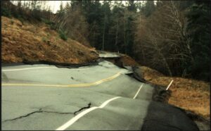
Paleoseismic work suggests a possible stress-triggering relationship between the Cascadia Subduction Zone (CSZ) and the Northern San Andreas Fault (NSAF) on the basis of similar event timings. The 1906 San Francisco earthquake produced turbidites on both sides of the triple junction (location where three tectonic plates meet), demonstrating that NSAF events have triggered turbidity currents in the southernmost CSZ and vice-versa. There are also similarities in timing and stratigraphy of turbidites deposited prior to 1906.
Ten CSZ turbidites deposited over the past 3100 years have a close temporal association with likely earthquake-generated beds along the NSAF, their median C14 ages differing by an average of 63±51 years. Many NSAF turbidites, particularly those closer to the triple junction, display a distinctive thick, inverted doublet stratigraphy consisting of a lower silty unit directly overlain by a robust sandy unit, the two commonly separated by an erosional unconformity. Doublets are also observed in the southern CSZ turbidites, though less commonly, and they fade northward.
The recurrence rate of major events near the triple junction is not the additive rate of both faults but is similar to the rate for either fault alone, implying the doublet beds represent pairs of turbidites, one from each fault, stacked together. One such pair is linked to the 1700 CE Cascadia earthquake on the Cascadia side of the triple junction and its counterpart of the same age on the San Andreas side. This event pairing is corroborated by similar event ages for the penultimate San Andreas event at numerous sites along the northern California coast and San Francisco Peninsula, including a new site at Lake Merced where recently published tree ring evidence indicates an event age of 1698-1700 CE.
In summary, we infer that the inverted stratigraphic doublets, event timing, and corroborative paleoseismic data are best explained by earthquakes on both systems occurring closely spaced in time, beginning with the CSZ. Alternative explanations, such as aftershock sequences or hydrodynamic generation, are less likely. This Holocene sequence of closely stacked stratigraphic pairs may represent direct evidence of stress-triggering and partial synchronization of earthquakes on these two great faults over the past ~3100 years. It also suggests the possibility of significant interaction at earlier times.
Login for the ZOOM only lecture will be provided through email ten days and two days prior to the event (if you are registered as a member). Otherwise, the login will be posted later on this page.
About the Speaker
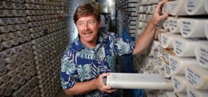
 Dr. Chris Goldfinger, emeritus professor at Oregon State University (OSU), is a marine geologist and geophysicist with a focus on great earthquakes and structure of plate boundary fault zones around the world. Chris has been involved in over 45 oceanographic cruises over the last 30 years, using many geophysical tools (deep submersibles, sidescan sonar, seismic reflection, etc.). He is currently working on great subduction earthquakes along the Cascadia, NE Japan, the Caribbean, and Sumatran margins, as well as the northern San Andreas Fault, where he uses the evidence for earthquakes found in deep-sea sediments.
Chris received his PhD from OSU in 1994. He is a Fellow of GSA and was the recipient of the 2016 GSA Kirk Bryan Award for Quaternary Geology. Windsurfing in the Columbia River Gorge and aerobatic flying are some of his favorite sports. He also loves sailing and has temporarily landed in Fiji.


 Tom Badger