About the Talk
Eruptive History and Hazards of the Mount Baker Volcanic Field
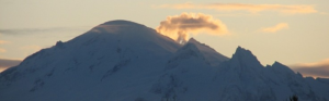
On a clear day in Port Townsend, you can’t help but notice Mount Baker to the northeast, just beyond Bellingham. Just 60 miles away, this spectacular volcano lies restless, its history largely unknown until recently.
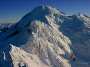 The geologic history of the Mount Baker Volcanic Field is now well documented for the past 3-4 million years. The ice-mantled cone of Mount Baker is but the youngest in a long series of eruptive centers, which includes two calderas (large eruptive cauldrons). The past 10,000 years (the Holocene) has seen a decrease in “constructional” lava flows.
Conversely, “destructional” events, such as flank collapses that evolve into far more hazardous lahars are now recognized as the Holocene norm at Mount Baker. Mount Bakers historical record begins in 1843 and ironically is among the most obscure, despite eye-witnesses reports and newspaper accounts. The reasons for the famous “failed-eruption” of 1975 is the latest example of the historic puzzle; this event provided the backdrop to the modern age of volcano monitoring in the Cascade and Aleutian arcs.
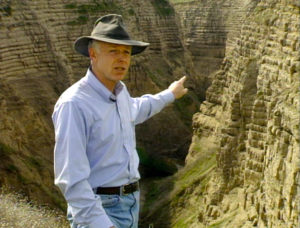
 About the Speaker
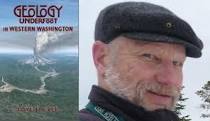
Dave Tucker is a Research Associate in the Geology Department at Western Washington State University (Bellingham) and Director of the Mount Baker Volcanic Research Center, which is the nucleus for ongoing volcanic research at the mountain. Dave has published (2019) Geology Underfoot in Western Washington. The book features several dozen field trips to exciting geologic sites in our region.
Book – Geology Underfoot in Western Washington (field trip guide)
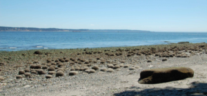
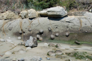 Advisors of the Geology Groups will run the rain-canceled beach walk on Marrowstone Island on Sunday, July 22, to see the Eocene and Pleistocene sections at Nodule Point, located near the southeast end of the island. This walk is timed for the low tide and participation will be limited (by parking spaces) to 50 persons.
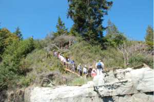 Walk. It’s about 2.4 miles from the East Beach lot to Nodule Point. Probable walking time, one way, is 1.5 hour–or more if we see interesting things in route. Arrival time at Nodule Point should be about 12 am (lunch). Collecting and/or defacing the outcrop is discouraged: please take nothing but pictures, and leave nothing but footprints. Wear your sturdy walking shoes/boots. Bring clothing for the weather, a pack, water, camera, and your own lunch. No bathroom facilities are available beyond the parking lot. We’ll plan to return to the parking lot by about 2:30 pm and be at Chimacum HS by about 3:00 pm.