We enjoyed hearing in-person USGS geologist, Dr. Brian Sherrod, on February 24, 2024 and by Zoom March 23.
THE LECTURE: High-resolution dating of a multi-fault earthquake and earthquake recurrence in the Salish Lowland
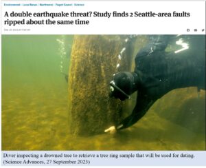
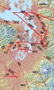
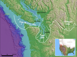
Dr. Brian Sherrod discusses new evidence for a multi-fault rupture. This rupture occurred along the Seattle (SFZ) and Saddle Mountain (SM) faults in the winter of 923-924 CE. He presents new evidence for a proto-historic earthquake on the Seattle fault (in the 1830s), and he talks about recurrence of large earthquakes in the Salish Lowland. He employs photographs, USGS mapping, lidar measurements, charts, and graphs to elaborate his points. Brian is a master story-teller, and his lecture will explain how this important event was detected.
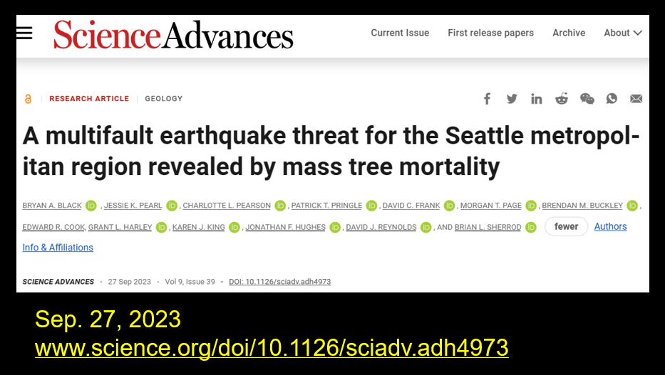
For a complete version of the research paper: Black, Pearl, et al., 2023, A mulitfault earthquake threat for the Seattle metropolitan region revealed by mass tree mortality: Science Advances 9, Sept. 2023
 THE SPEAKER:
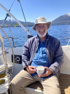
Dr. Brian Sherrod is a Research Geologist and Pacific Northwest Regional Coordinator for the USGS Earthquake Hazards Program, based in the Department of Earth and Space Sciences at the University of Washington.
He received his BS in Geology from James Madison University in Virginia, his MS in Geology from the University of Pittsburg, Pennsylvania, and his PhD in Geological Sciences from the University of Washington. His main area of research is paleo-seismology: finding evidence of past earthquakes in the Pacific Northwest using geological records. Much of his work uses lidar. His recent projects include looking for evidence of surface rupture along faults in central and western Washington, coastal uplift, and subsidence along faults in the northern Salish Lowland.
 Ralph Haugerud is an exceptional geologist. Many describe him as a structural geologist and geologic mapper interested in the evolution of the Pacific Northwest, and many know about his popularity from being featured on Nick Zentner’s programs.
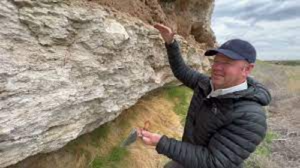
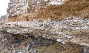 Calcrete is a CaCO3-rich hardpan paleosol that forms in dry, stable landscapes of the world. Calcrete in eastern Washington cements a 20-m-thick interval across three geomorphic domains: Palouse Hills, Channeled Scablands, and Yakima Fold Belt. The sheet-like calcrete deposit encloses ancient Scabland flood gravels and defines a regional paleosurface that has been bent and broken by Quaternary faults. Calcrete overprints primarily lowland alluvial deposits (ancestral Columbia-Snake River floodplain) and basaltic alluvial fan gravels shed from fault-bounded ridges. Thick layers of pedogenic carbonate accumulated during the Pleistocene, between about 1.8 million years ago to about 40 thousand years ago, but older cements at somewhat deeper levels date back to ~7 million years (late Miocene). The appearance of arid-land calcrete in eastern Washington coincides with the topographic rise of the Cascade Range and establishment of a strong rain shadow east of the divide. This lecture shed new light on this lesser-known part of eastern Washington’s stratigraphy.
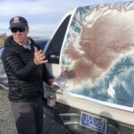 The Speaker