2024-03-23 Brian Sherrod — New Findings on Earthquakes of Salish Lowland with Tree Analysis

We enjoyed hearing in-person USGS geologist, Dr. Brian Sherrod, on February 24, 2024 and by Zoom March 23.

THE LECTURE:  High-resolution dating of a multi-fault earthquake and earthquake recurrence in the Salish Lowland

See Sept. 2023 Science Advances article: https://www.science.org/doi/10.1126/sciadv.adh4973

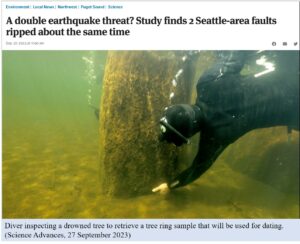
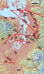
Dr. Brian Sherrod discusses new evidence for a multi-fault rupture. This rupture occurred along the Seattle (SFZ) and Saddle Mountain (SM) faults in the winter of 923-924 CE. He presents new evidence for a proto-historic earthquake on the Seattle fault (in the 1830s), and he talks about recurrence of large earthquakes in the Salish Lowland. He employs photographs, USGS mapping, lidar measurements, charts, and graphs to elaborate his points. Brian is a master story-teller, and his lecture will explain how this important event was detected.

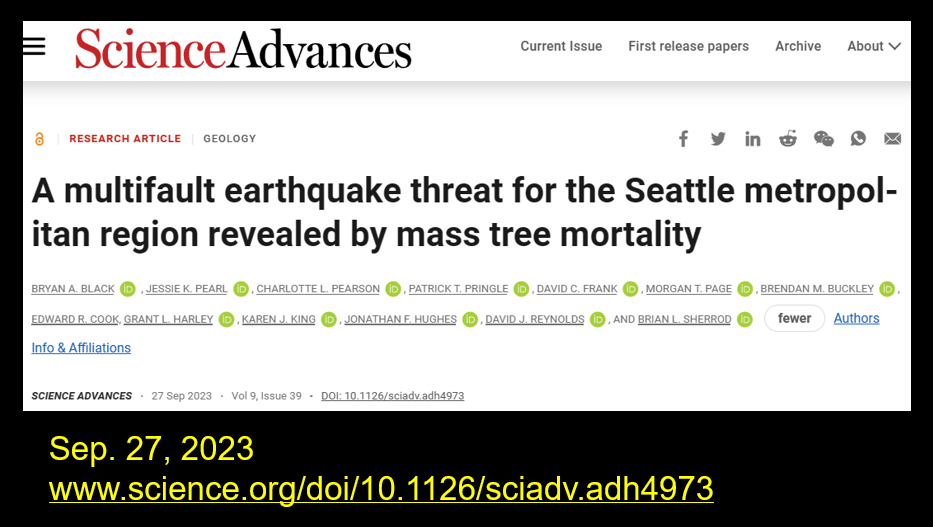
For a complete version of the research paper:  Black, Pearl, et al., 2023, A mulitfault earthquake threat for the Seattle metropolitan region revealed by mass tree mortality:  Science Advances 9, Sept. 2023

THE SPEAKER:

Dr. Brian Sherrod is a Research Geologist and Pacific Northwest Regional Coordinator for the USGS Earthquake Hazards Program, based in the Department of Earth and Space Sciences at the University of Washington.

He received his BS in Geology from James Madison University in Virginia, his MS in Geology from the University of Pittsburg, Pennsylvania, and his PhD in Geological Sciences from the University of Washington. His main area of research is paleo-seismology:  finding evidence of past earthquakes in the Pacific Northwest using geological records. Much of his work uses lidar. His recent projects include looking for evidence of surface rupture along faults in central and western Washington, coastal uplift, and subsidence along faults in the northern Salish Lowland.


2023-12-09 David Brownell—Drainage evolution of the Dungeness River

The Lecture

David Brownell, Executive Director of the North Olympic History Center, discussed the shifting “paleochannels” of the Dungeness River and established an environmental and anthropological framework to reach a better understanding of the history of the Dungeness River since the end of the last ice age.

During the last glacial epoch, the Dungeness River discharged its alluvium and built a large depositional complex that extends from the mountain front at Bell Hill north to and including the Dungeness Spit, an intriguing feature on its own (see side image).

We looked at archaeological, geological, and other evidence to “recreate” the landscape of the North Olympic Peninsula as it adapted to changes in climate, biology, and other factors.

The Speaker 

David Brownell moved to Washington in 2015 to take a position as the Cultural Resources Specialist for the Jamestown S’Klallam Tribe. During his time with the Jamestown Tribe, he was responsible for government-to-government consultation with federal, state, and local agencies regarding impacts to cultural sites; curation of the Tribe’s artifact and archival collections; repatriation of ancestral remains and artifacts; education, outreach, and much more. He also worked extensively with Jefferson Land Trust’s conservation team to secure and protect the Tamanowas Rock Sanctuary, and to educate and train Land Trust staff members.

As Executive Director of the North Olympic History Center, he manages a collection of thousands of photos, artifacts, books and more. We are currently digitizing our collections and making them available to the public at www.nohc.catalogaccess.com, as well as planning exhibits and programs for 2024. On the side, I have a small farm in Sequim where I raise goats, chickens, and lots of fruits and veggies.