About the Talk
The great Missoula floods and other megafloods of the Columbia River: Agents of catastrophic landscape change in Washington
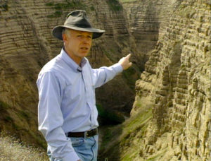
Dr. Richard Waitt of the U.S. Geological Survey (Vancouver, WA) will present a fascinating review of the Great Missoula Floods, which has been a topic of interest of his for several decades.
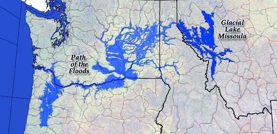
As a result of more than 40 years of research, the great Missoula flood is now known to have consisted of perhaps 100 repeated floods that occurred intermittently across several millennia. A single monstrous ‘Spokane Flood’ was first proposed in J Harlan Bretz in 1923, as an agent of catastrophic landscape change in Washington. The hypothesis of scores of gigantic Missoula floods was proposed and developed by Richard Waitt and Brian Atwater in the late 1970s to late 1980s.
Between about 18,500 and 15,000 years ago, immense floods from glacial Lake Missoula in Idaho and Montana drowned the Wenatchee reach of the Columbia Valley by different routes. The earliest debacles raged 1,000 feet deep down the Columbia and built the high Pangborn bar at East Wenatchee.
After advancing ice blocked the Columbia valley north of Spokane, several great floods descended Moses Coulee (channel) and up the Columbia past Wenatchee. When ice covered intakes to Moses Coulee, the Grand Coulee and Quincy basin became the westernmost floodway. Receding ice-dammed glacial Lake Columbia until it burst. Smaller great flood(s) swept down the Columbia probably from glacial Lake Kootenay in British Columbia. Huge fluted points produced by early man (Clovis) atop Pangborn bar were buried by loess starting about 13,000 years ago. Although Clovis people came to the Northwest two millennia after the last Missoula flood they may have seen outburst flood(s) from glacial Lake Kootenay.